Cloud Nine

Saturday, April 21, 2007

In which I run 13.1 miles

The hills I praised so generously here and here? They hate me. No, they really do. Today, I ran more than I have ever run before; I ran for 13.1 miles or thereabouts. The approximation is because this was a trail run, where it is rather hard to measure distances accurately. And the trail has a 1600 feet ascent and descent. There, I had to get that out there before I revealed that it took me 2:37:50 according to the "chip and dale" system used by Enviro-sports. It was definitely much slower than my target time, but I did attain my first target of finishing! And the hills, yeah, were way tougher than I was prepared for. A half mile hill at 20%? Phew.

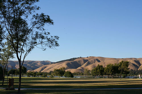
We started out at 9:10 am from the parking lot of Skyline Ridge County Park. There were 200 participants, the maximum number of permitted runners on the trail. After circling around the lot, we hit the trail, which begins to climb almost immediately. Now, I had followed the online running pundits and planned to do everything just as I had done on my training runs to avoid any unexpected results, except, I had a bottle of Gatorade in my hand. I don't own one of those belt thingies or a camel back, and thought I could wing it by running with the Gatorade in my hand. But as my arms ached, I realized it would not be quite that simple. So about a mile into that first hill, I took a sip of the Gatorade and chucked it behind a tree to be picked up on the way back. After that initial hill, I felt warmed up, and began enjoying myself. Skyline Ridge is a beautiful park with meadows, forests and ridgelines. At one point, I mounted a hill and saw blue-and-white sky and verdant hills stretching endlessly. The sky almost seemed to put both its arms around me in comfort. It felt for a second like I was running off the edge of the earth. Hey, with such a view, not too bad.

Soon, I reached the 3-mile mark, the first turn around. I did not drink anything at the aid station because I could feel the Gatorade I had drunk sloshing somewhere in my depths. No more water, thanks. Now to find the precious Gatorade that I had discarded on my way up. So what had I used as a marker to find that particular tree? You guessed it, the cloud above that tree which was a peculiar shape. But seriously, as I dropped the bottle, I had looked back and tried to capture that view in my head so that I could identify it on my return. And given that I was in better shape on my return downhill, I thought I saw the tree. There sat the artificially-colored, sugar-loaded super liquid in a non-biodegradable plastic bottle! I had won the Earth Day treasure hunt! Oh wait, this is a half marathon.

At the 6-mile mark, I took another swig of the Gatorade, and left it at that aid station. The next mile or so was fairly tame from an elevation standpoint. We passed Horseshoe Pond, a clear and serene pond, which made me want to stop and stare. It all went downhill from there, err, uphill actually. All the 20% hills were in this portion of the run. There was this lady who had been taming the uphills mercilessly, but slowing down on the downhills. I was inspired and ran as much as I could on all the uphill stretches. And overtook her on the downhills (evil grin). All the views were breathtaking, and after a point, I wished I had some breath left. I passed some beautiful meadows where the merry wildflowers pepped me up to the 9 mile mark. Sip some water, chat with uphill-runner-queen and storm downhill. During the last few miles, my legs gently let me know that they were tired. I pretended not to listen, and kept going. Oh the relief when I saw the glistening water of Horseshoe Pond! I stepped up the pace as much as my poor legs would let me and finished! 2:37:50. Not great, and actually quite a poor pace. But for my first half marathon, and with 1600 feet elevation gain, I'll take it.

Such a trail run (as opposed to crowded road runs) is good because for most of the run, I was on my own, occasionally catching sight of someone ahead. This is not to say that people did not pass me or vice versa. Just that it didn't seem clustered. So whether I was exclaiming over a pretty wildflower or cursing the hill, I didn't have to feel too embarrassed about it! Plus you get to share your experience as it happens with fir trees, just-out wildflowers, tranquil ponds, and yes, even those nasty hills. The Enviro-sports volunteers and most runners were friendly and in high spirits. If there was one downside, it was that many portions of the trail were too narrow even for 2 people to cross each other without stepping off the trail. I would recommend Enviro and trail running, but probably not as your first half- or full-marathon. A road run would have probably given me the practice running the distance, and then I could taken on the elevation change as the next step. Very enjoyable and memorable nonetheless. Yay!

Monday, April 09, 2007

Order please?

I'm at the grocery store. Ahead of me in the checkout line is an older man, along with his partner, an older woman. As the gentleman patiently counts the notes and coins to hand over to the cashier, their groceries are bagged. I notice the young man behind the counter tie a firm knot on one of the plastic bags. He hands it over to the old lady holding her cart, her snow white hair impeccably in place. The knot is firm, much too firm. He probably tied it that tight to make sure that nothing inside spilled out. He probably did it with the good intention of avoiding the trouble that the older couple would have handling such a spill. But what if the old lady was arthritic, and has trouble untying the knot? Would she be frustrated that she could not even open a bag of grocery?

Such little dilemmas run through my mind whenever I see older people. Should I run out and open the door for them, or would they think it a loss of dignity? I was fortunate enough to grow up in a home where my grandparents were the heads of the family. My grandfather was a proud and independent man, and my grandmother was, well, stubborn. As they grew older, I saw how difficult it was for them to receive any form of unsolicited help. Actions out of pity or indicating dependence were usually not tolerated, or when necessary, borne with grit teeth. We naturally waited until we were asked to do something, because then, you see, we were following orders.

So to all the handsome grandfathers, and lovely grandmothers, may I take your order?

Saturday, March 31, 2007

Permanent Residency (or Permanent Retrogression)

If you are a desi in America, you've been there. Sat around with friends and complained no end about how frustrating it is to wait for the elusive Green Card, also known as Panacea For All Problems; envied the friend who married a citizen and simplified the process greatly; wondered if the janitor had one, while you (Ph.D. and all) still waited.

Let's take a step back, and look at where we come from. I had this surprisingly emotional discussion with an older Chinese co-worker, who shared with me how hard his childhood had been. It began with him telling me about his daughter's participation in a 30 hour famine to make a contribution towards solving world hunger. He said that he was encouraging her so that she would learn the value of the food they eat, and that there are others who are not as lucky. For some reason, he then went on to tell me how much he went through growing up. His mother died when he was 2, and his father raised him alone. They left China for Hong Kong, although his father had not much more than hope, by way of professional skills. They often had no home, and slept at his father's place of work. Today, he is in the Silicon Valley with a wife and two daughters, but they now own a home, a car and everything else that goes with an American way of life. I don't know about you, but I can definitely relate to some of his experiences. My parents have told my sister and me many incidents from their lives, times when they studied under the light of a hurricane lantern because there was no electricity, times when they slept in the kitchen because it was the biggest room in the house, times when they walked 5 km to school, times when our grandparents had no money to buy a train ticket but had to travel to make a living (irony!). We are indeed fortunate to be in a position that is materialistically better than theirs. And lucky to have enough to live comfortably, and realize and appreciate the value of everything we have.

Now that the lower rungs of Maslow's pyramid are satisfied, we must move up. And we all do - we gravitate towards money, power, fame, and success, however we may define it. Often, people perceive the difficulty involved with the green card process as a deterrent towards their goals. But is it, really? Don't let it ruin your mood, or rule your decisions (not too much, at least). If you are determined to succeed, you must be prepared to face many challenges, and surely a crappy immigration system and a badly managed process are not enough to deter you? Given that the whole thing is mostly out of your control, how you deal with it is very dependent on your individual situation; it may mean being patient in your current position, throwing caution to the wind and leaving to another exciting position, going back to school, going back to India to capitalize on the growth etc. Whatever works. If those before us managed to overcome the lack of basic necessities, and still do well enough to educate their children and get us this far, we with all our material comforts can do better (green card or not).

Tuesday, March 06, 2007

Fries anyone?

On reading about the recent furor regarding restaurants being required to publish calorie information on menus in New York city, I found myself thinking about nutrition information and how its availability influences our choices. Before I came to the US, I did not look at a single nutrition label, not a single one. Probably because there were none to look at. Thankfully for me, parents made sensible and healthy choices on my behalf (mostly). When I realized how much information was out there, and how easily accessible it all was, I dove right in.

I quickly learned a thing or two:

BAD - may be used, but only in moderation:
- processed foods (ready-made or pre-made anything)
- refined flours (white bread, regular pasta)
- excessive use of oil, butter, dairy, sugar

GOOD:
- vegetable and fruit
- lentils and beans
- tofu, soy products
- nuts and seeds (just watch the calories)
- whole wheat (ww bread, ww pasta)

I definitely enjoy the ice cream or cookie fix (the true reason for my running so much). But I realized that by habituating a lot more of the good things, I need to worry less about the occasional indulgence in the bad. It is really easy to spend the quick second scanning any nutrition label to check calorie, fat, sugar and fiber content. I also usually check the ingredient list for the usual suspects (high fructose corn syrup, processed or bleached flours, oil when none should be necessary etc.). It is worthwhile to spend the extra 10 minutes looking up a restaurant that I know I'm going to head to for that friend's birthday dinner to get an idea of the menu beforehand and check nutrition information. Now, that is not to say that you always order the salad and skip the dessert (oh, what would we BE without that tiramisu!), but more to make well-informed choices: maybe take half the entree to go if you are planning on getting the death-by-chocolate cake? Bottom line, eating mostly fresh food, getting some exercise and limiting the "treats" to special occasions is not that hard, and will keep you healthy and happy.

Having all this information (and not just about food and nutrition, but also about exercise and fitness) at my disposal makes me wonder about those that do NOT have access to it. The high rate of obesity among certain demographic groups is probably because they are more likely to not have access to such information, or even know that it exists. Given that, isn't it only fair that we make this information as accessible as possible to all?

And while we are at it, I do not know a single Indian restaurant that shares its nutrition information, do you?

Saturday, February 17, 2007

Hiking Loma Prieta

Remember the big earthquake in California in 1989? In spite of the fact that the epicenter of that earthquake was near the highest point in the Santa Cruz mountains, its effects were felt as far as San Francisco and Oakland. That peak is called Loma Prieta and that was the destination of yesterday's hike.


The view from the top (Pacific Ocean towards the left)

Although SummitPost has an entry for this peak, I must warn you that Loma Prieta is not really a hikers' mountain. We mostly followed this route for the 12-mile out-and-back hike, but I want to add some more information that may avoid other hikers getting slightly lost, like we did.


Getting there:
While the directions here work, we just used Mapquest to find our way to Uvas Canyon County Park. Take US-101 south to Bailey Road. Go west on Bailey for about 3 miles (you will pass an IBM campus) until you hit a T-junction. Make a left onto McKean road. Follow McKean road for about 6 miles, somewhere along which McKean becomes Uvas Road. Make a right onto Croy Rd. Continue on Croy Road and follow signs for Uvas Canyon County Park (you will pass signs that say "Sveadal" and private property). Pay at the machine, pick up a Park map and park at the day-use parking lot to the right.

VJ's lonely car at the parking lot (circa 8 am)

The Hike (all distances approximate):
- Walk along the paved road and cross a bridge (you can ask for the "Youth Group Area" if you encounter campers or a ranger). After passing an information station on your left, look for a gate that will take you into a campsite. Find the beginning of Knibbs Knob Trail at a gate between campsites 27 and 28.
- The first 2 miles of the hike are STEEP, and being within the confines of the County Park, can be easily followed on the map. The first junction is about 1.5-1.7 miles into the trail, where the Knob Trail takes off to the right. Stay straight to continue on Knibbs Knob Trail. At the two mile point, you cross a gate indicating that you are leaving Uvas Canyon Park and hit Summit Road (aka Mt. Madonna Road).
- Turn right on Summit Road. This is a paved road which is open to traffic, so stay on the left side of the road and watch out. The road does not have much shade, and you will find several private property homes along the way. At some point, you are rewarded with breathtaking panoramic views of the Pacific Ocean.
- After about 2-2.5 miles on Summit Road, there is an almost-T junction. While Desai tells us to turn right onto Loma Prieta Road, there is no sign to indicate this. One way to confirm that you are at the correct junction is to just pass it, turn around facing the road you just came on, and you will see a iron pillar/post on the roadside saying "Summit Road". It was probably painted "Loma Prieta Road" on the other side at some point, but that is no longer visible. Also, as you turn right, there are signs saying "Authorized or registered vehicles only" or something to that effect. There was no such warning for hikers, so we persisted and followed the road winding up.
- About a mile on this uphill road to reach the base of the peak where there are at least three roads winding eastward to the peak. Do not take the one most to the right (which tends downward), take the one to the left of it, as Desai instructs us to. Now just continue on this road, past a gate and winding upwards until you get to the top (or just ignore the road and scramble up the hill like we did!). Once you see the peak, identified by the many transmission towers and associated ugliness, you don't really have to worry about routes or trails, any way that takes you up is just fine.
- Retrace your steps back to the Uvas Canyon parking lot.

Total mileage: ~12 miles round trip.

Easy way to identify the peak!

What's that? Where did we get lost you ask? It was right at "Loma Prieta Road", where a helpful man told us to turn left (in the opposite direction from what is described above) to get to Loma Prieta. Thankfully, we met a delightful old gentleman in a pickup, who told us more than we needed to get to the peak, and even warned us not to stay too long amidst all those microwaves! Dig that white beard!

What to take:
- Water! I lugged about 2 liters, but ended about using only about 1 liter. The route can get really hot, so to be safe, carry about 2 liters.
- A light snack (or lunch if you like)
- Sunscreen
- Wear hiking boots, some sections of the hike require good grip.
- If you have knees that hurt when coming downhill, I would recommend hiking poles that will help while returning on the very steep portion of Knibbs Knob trail.

Other recent hikes:
Black Mountain at Rancho San Antonio Park
Two Ponds Hike at Skyline Ridge Open Space Preserve

Happy Hiking!

Labels: ,

Tuesday, December 19, 2006

The Hills


On days like today, the hills appear hazy and recline shyly under their veil of dust. But there is hope for clearer days in the winter. Days in which the hills, in their green and brown skin, stand tall as a beautiful contrast to the blue sky. And then, there are days, like one last week, when the fog is so thick that the cars on the highway use only the gleaming red eyes of the car in front of them as a guide. The signs on the highway and the trees beside appear out of the fog like ghastly shadows in a moor. I could not see more than a few feet in front of me, but I could feel the hills behind the fog curtain, strong and silent, like an unseen yet steadfast protector.

And on days when I am out climbing the hills, I look at the tiny cars on the highway and wonder if they notice the hills.

Photo: Thanks to vzaliva's Flickr set (via Google).

Labels:

Wednesday, November 08, 2006

Memories of Whitney

Remember the Whitney trip? Want to know more? Head on over.

Labels: